
Highlighted Activity
Highlighted Media
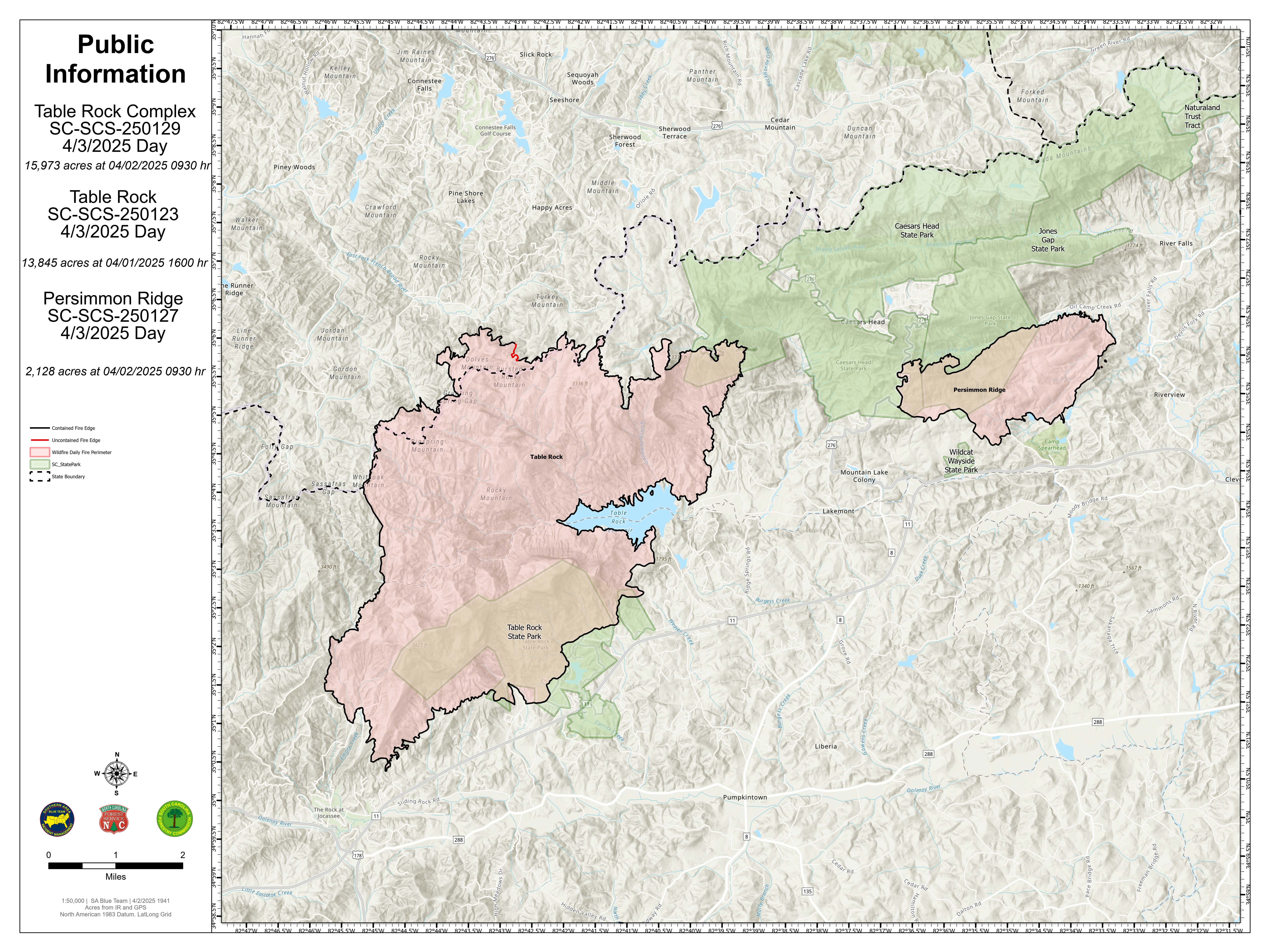
The Table Rock Complex is approximately 20 miles northwest or Greenville, South Carolina. The complex consists of the Table Rock Fire and the Persimmon Ridge Fire. The Table Rock Fire is located in Table Rock State Park and is currently active in South Carolina and North Carolina. The Persimmon Ridge Fire is located in Caesars Head State Park, it is active in South Carolina.
Table Rock Fire: 13,845 acres, 94% contained
Persimmon Ridge Fire: 2,128 acres, 99% contained
Table Rock Complex Total: 15,973 acres, 97% contained
| Current as of | Fri, 04/04/2025 - 09:04 |
|---|---|
| Incident Time Zone | America/New_York |
| Incident Type | Wildfire |
| Date of Origin | |
| Location | 4 miles NE of Sunset, SC in Table Rock State Park and Caesars Head State Park |
| Incident Commander | Charlie Patterson IC |
| Incident Description | Wildfire Complex |
| Coordinates |
35° 3' 52'' Latitude
-82° 38' 45
'' Longitude
|
| Total Personnel: | 165 |
|---|---|
| Size | 15,973 Acres |
| Percent of Perimeter Contained | 97% |
| Estimated Containment Date | 04/05/2025 |
| Fuels Involved | Timber (Litter and Understory) Fine fuels are saturated and not available to carry fire. Fuels are now limited to 100- and 1000-hour |
| Significant Events | Rainfall over the fire area today continued to reduce fire activity. Fuels are moist with continual, light, misty rainfall which persisted most of the morning and early afternoon. Fire behaviour is limited to slowly burning hurricane debris and fallen logs which have retained heat. An occasional light smoke is visible mixed with the low cloud cover from the smoldering fuels. |
| Planned Actions |
Table Rock Fire: Suppression repair across the Complex Persimmon Ridge: Suppression repair across the Complex |
|---|---|
| Projected Incident Activity |
12 hours: The potential for fire activity this evening is very low due to moist conditions. |
| Remarks |
Blue Team is demobilizing on 4/5/25. |
| Weather Concerns | The overnight period will feature slowly clearing skies and will become mostly cloudy with warmer temperatures in the middle 60s and relative humidity recovering to 90% to 100%. Winds will be light and a stray shower can't be ruled out. Into the day on Friday, you can expect mainly sunny skies with temperatures warming into the lower 80s and relative humidity dropping into the upper 40% range. Winds will be from the southwest with some gusts reaching 18 mph today. Saturday will be a mainly dry day as high pressure remains in control. Temperatures will again be around 80 with relative humidity only dropping into the upper 30% range. Winds could gust up 20 mph from the southwest during the day. Sunday will feature a cold front beginning to move through the region. The afternoon will feature the potential for strong to severe thunderstorms with plenty of rainfall potential. Strong winds will also be associated with the cold front. |
|---|