
Highlighted Activity
With spring approaching, firefighters are closely monitoring conditions for potential burn windows. Please continue to check this page for the latest information, which will be highlighted in the space above this information.
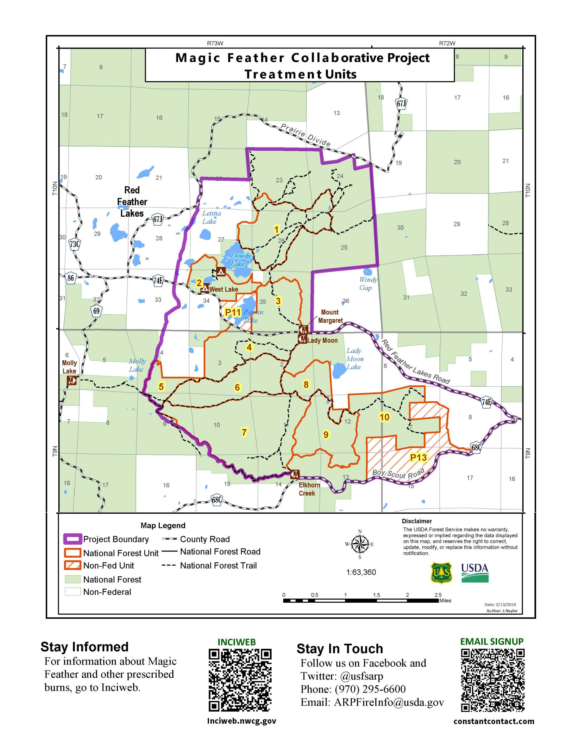
Prescribed fires are used to reduce overgrown vegetation to help protect local communities, infrastructure and natural resources from wildfires. The Magic Feather Project is now in its fifth year of burning, located east and southeast of Red Feather Lakes along Red Feather Lakes Road (County Road 74E). Since April of this year, wildfire managers have successfully treated 500 acres through broadcast burning at Magic Feather.
This project is being executed in a phased manner, with 2,700 acres currently under observation for appropriate conditions. Required prescribed fire conditions include appropriate weather, fuel moistures and smoke dispersal as well as adequate personnel to support the planned project. Weather is monitored throughout the potential burn window and ignitions will not occur if conditions fall outside of the required prescriptions.
Residents and visitors in the vicinity should anticipate the presence of smoke during the prescribed burning operations. Smoke is most likely to be visible from Red Feather Lakes and Northern Front Range communities. Smoke may also impact those using the Dowdy Lake and West Lake recreation areas Prescribed fire smoke may affect your health. For more information about the potential health impacts of smoke, visit Colorado Department of Public Health and Environment.
To receive updates, follow us on Facebook and X and join our email list through Constant Contact and select list "Forest Health & Fire: North of Hwy 14 to Wyoming Border (Red Feather Lakes)."
| Current as of | Wed, 04/16/2025 - 11:09 |
|---|---|
| Incident Type | Prescribed Fire |
| Location | E/SE of Red Feather Lakes |
| Incident Commander | Canyon Lakes Ranger District |
| Coordinates |
40° 46' 46.5492'' Latitude
-105° 32' 16.692
'' Longitude
|